UK national ammonia emissions and diagnosing sources of urban PM2.5
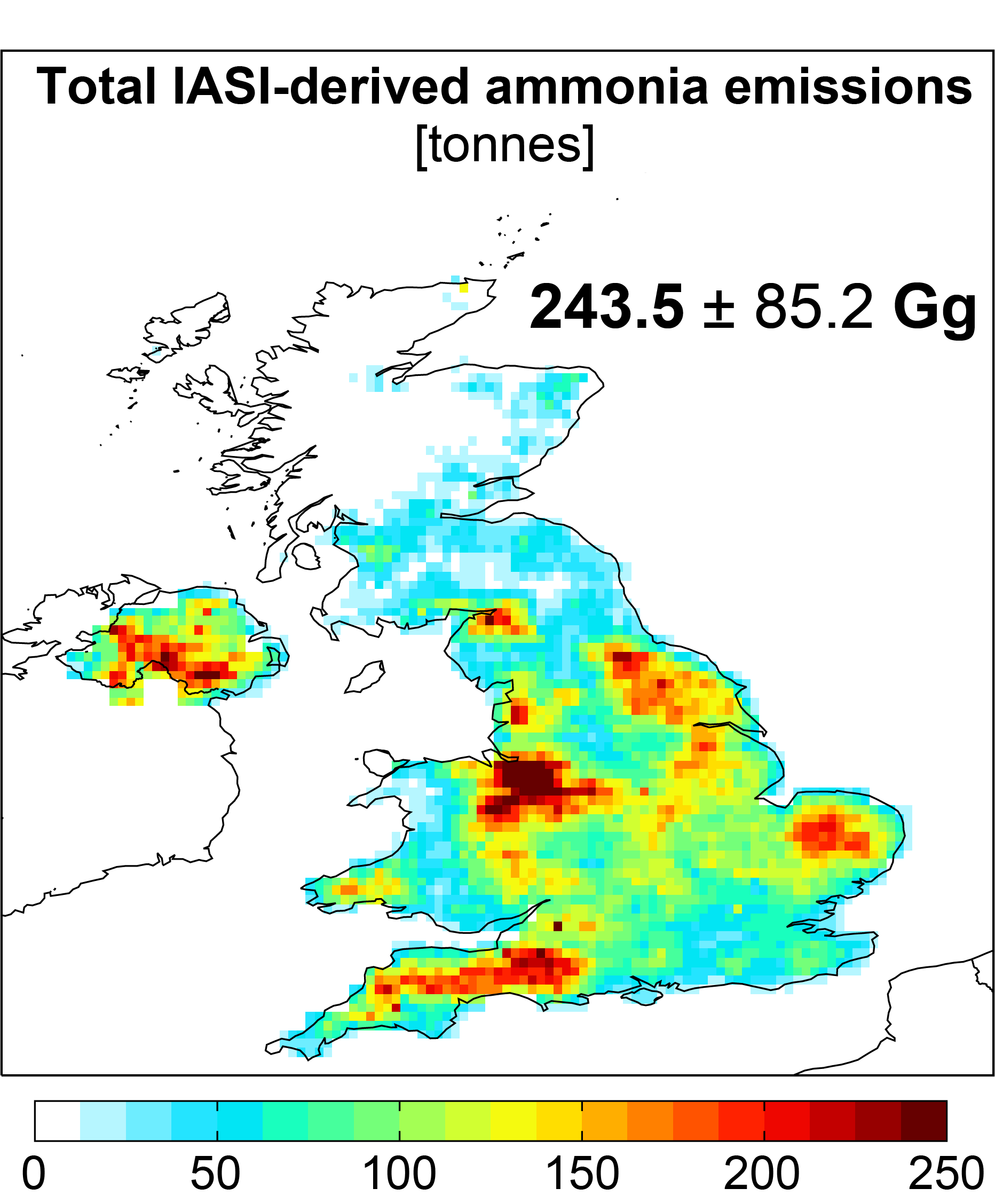
Satellite-derived ammonia emissions in the UK obtained using two sensors in space, IASI and CrIS, and the GEOS-Chem model, and local and transboundary contributors to PM2.5 in cities in the UK, with a focus on Leicester.
People: Jamie Kelly
Funding: DEFRA, Leicester City Council
External Collaborators: EarthSense, ULB, Rothampsted, ECC, AER, SUSTech
Tools and Data used: GEOS-Chem, CrIS, IASI, UK national monitoring network, UK National Atmospheric Emission Inventory
New Datasets generated: Satellite-derived estimates of ammonia emissions in the UK. [Link to Data].
Reference:
E. A. Marais, A. K. Pandey, M. Van Damme, L. Clarisse, P.-F. Coheur, M. W. Shephard, K. E. Cady-Pereira, T. Misselbrook, L. Zhu, G. Luo, F. Yu, UK ammonia emissions estimated with satellite observations and GEOS-Chem, 126 (18), J. Geophys. Res. Atmos., doi:10.1029/2021JD035237 [PDF]. [ESSOAr preprint link]